Precio incl. 21% IVA legal
Disponible como descarga inmediata
- N.º artículo: AS13986
- Fabricante: France VFR
- Idioma: Deutsch/English/Francais/Espanol
- Versión actual: 1.00
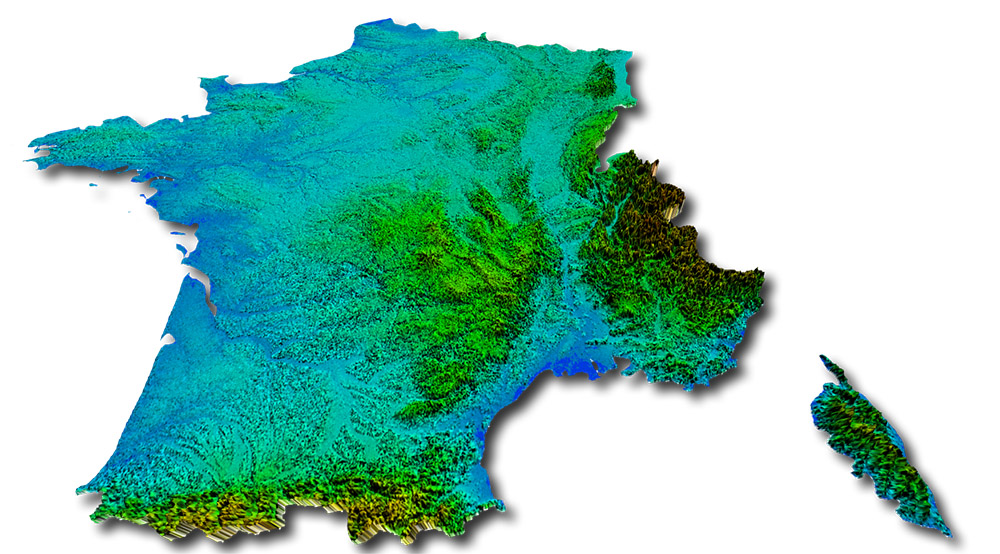
The FS Mesh Europe series provides a terrain mesh coverage for several Western European countries with a unique 4.75 meters resolution. The bundled Western Europe product is resampled to a limited 19m resolution.
Features :
- France – 618 000 km²
- Ultra HD terrain mesh resolution - 4.75 meters
- Elevation data source : NEXTMap® Europe program by Intermap Technologies®
- Less than 15 cm vertical precision
- Optimal compiling compression ratio for better quality/performance compromize
- 0.5 degree x 1 degree grid splited files to optimize memory loading process
- Full compatibility with France VFR® photoreal sceneries
- Ability to combine NEXTMesh with other lower resolution generic meshes
In order to detail our NEXTMesh specifications, it should be recalled what a mesh is and which parameters are used to describe it.
Mesh Gridding
In FSX, a mesh is a horizontal grid of the Earth’s surface for supporting the numerical description of the relief. The smaller the grid, the finer terrain relief will be. The global mesh in FSX has a 4.8 km resolution. Europe regions have improved resolution with a 76m mesh resolution. Our HD mesh “whole Europe” is a 19m resolution. NEXTMesh EUROPE – Domestic products at Ultra High Definition are designed with the very best data currently available which is a 5m grid allowing the finest restitution.
Vertical Precision
On the other hand, the quality of a mesh can also be measured by its vertical resolution. That is, the precision of measured elevation of each point of the grid. Basic FSX has a vertical resolution of 1m. Our data is accurate to less than 10cm
Resampling
Finally the data have to be compiled to be usable by FSX. They are resampled according FSX world grid index system called LOD. This can lead to abuses (see below). Our Ultra HD products are resampled with 4.75m resolution and a vertical accuracy of 12.5cm. Compression rates are optimized to reduce files sizes and preserve data.
Also the files are devided in areas of 0.5° x 1° to optimize the memory occupation and loading time.
Microsoft Flight Simulator (SP2) X or Prepar3D v3
Windows 7 (64 bit recommended)
CPU: min. 2 GHz Dual Core (3 GHz recommended)
RAM: min. 4 GB or higher
Graphics: min. 2 GB (DDR5 PCI-E) or higher
Download-Size: 5.8 GB


